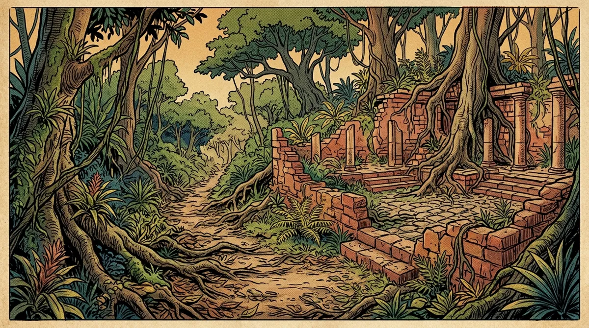
No extremo oeste da Amazônia brasileira, no estado do Acre, a abertura de pastagens agrícolas a partir dos anos 1970 revelou algo totalmente inesperado gravado diretamente na superfície terrestre. Sob a densa floresta tropical, o relevo exibia formas geométricas perfeitas: círculos, quadrados, pentágonos e hexágonos desenhados por meio de valas profundas e aterros lineares. Conhecidos como geoglifos, essas estruturas revelam formas complexas de ordenamento territorial milenar.
O que são os Geoglifos do Acre?
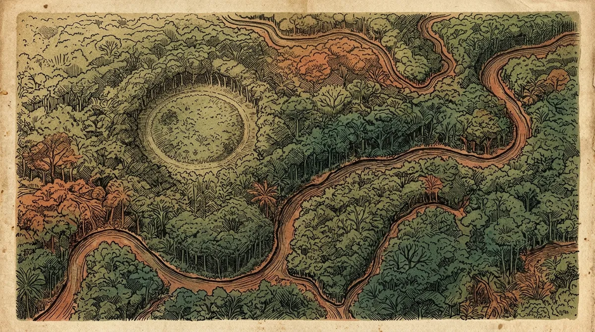
Os geoglifos são valas geométricas escavadas no solo argiloso, cercadas por baixas muretas de terra que acompanham os contornos da escavação. As dimensões dessas estruturas são monumentais:
- Diâmetros de Escala: Muitos círculos e quadrados possuem diâmetros que variam de 100 a 300 metros, cobrindo áreas equivalentes a vários quarteirões urbanos.
- Dimensões de Vala: As trincheiras de contorno medem comumente de 2 a 11 metros de largura, com profundidades que alcançam até 4 metros abaixo do nível do solo natural.
- Cronologia Estável: Pesquisas com carvão associado apontam que os geoglifos foram construídos e utilizados principalmente entre o ano 1 d.C. e 1000 d.C., correspondendo ao período medieval europeu.
A precisão dessas formas geométricas indica que os construtores possuíam técnicas de topografia empírica e noções de geometria aplicada. Algumas valas geométricas são conectadas por caminhos elevados e trincheiras retilíneas que apontam para outras estruturas vizinhas, revelando redes regionais integradas.
O Enigma da Função dos Geoglifos
A função exata desses desenhos gigantes no solo do Acre é tema de investigações arqueológicas contínuas. A ausência de vestígios residenciais tradicionais (como cinzas domésticas frequentes, restos cotidianos de alimentação e abundância de lascas utilitárias de ferramentas) indica que essas estruturas não eram aldeias permanentes ou cidades residenciais fortificadas.
Pesquisadores como Sanna Saunaluoma e Alceu Ranzi propõem que os geoglifos eram espaços rituais e cerimoniais sagrados. Funcionavam provavelmente como centros de reuniões temporárias de grupos interconectados para celebrações, rituais funerários, alianças políticas e intercâmbios de sementes e mercadorias. Os aterros elevados que circundam as valas poderiam servir de palanques para observadores assistirem às cerimônias realizadas no centro livre da estrutura.
| Aspecto Arqueológico | Evidência Encontrada | Interpretação Científica |
|---|---|---|
| Lixo Doméstico | Extremamente raro ou ausente no interior dos anéis de terra | Indica que os locais não funcionavam como residências permanentes |
| Estradas Elevadas | Caminhos de terra retilíneos que partem dos acessos das muretas | Mostram rotas de trânsito ritual e conectividade regional planejada |
| Manejo Vegetal | Vestígios de grãos de pólen indicando espécies florestais úteis | Sugerem que as estruturas ficavam cercadas de pomares protegidos e clareiras |
A Amazônia como Floresta Cultivada
A descoberta dos geoglifos do Acre enfraquece definitivamente a premissa de que a floresta amazônica era intocada e desprovida de modificações antrópicas profundas antes de 1500. A paisagem do Acre foi ativamente gerida por populações que alteraram os perfis topográficos da terra, abriram clareiras e moldaram a composição de espécies vegetais nas imediações dos geoglifos.
As pesquisas polínicas de solos associados revelam que os construtores realizavam queimas locais controladas para manter as estruturas limpas, plantando espécies economicamente valiosas como o açaí, a pupunha e o castanheiro. A própria floresta ao redor das muretas geométricas funcionava como um jardim antropogênico sustentável.
A Tragédia Reveladora do Desmatamento
Existe uma ironia histórica e científica na história dos geoglifos do Acre. A existência da maioria dessas estruturas monumentais só se tornou visível porque o desmatamento promovido pela agropecuária removeu a densa copa das árvores que as escondia por séculos. A devastação da floresta revelou a arqueologia do lugar.
Contudo, a mesma atividade econômica que expôs os geoglifos agora ameaça destruí-los de forma irreversível. O avanço de tratores de esteira, a aragem profunda para plantações de grãos, a abertura de valas de drenagem rural e o pisoteio contínuo de gado degradam rapidamente os aterros de argila e misturam as camadas do subsolo antes que os arqueólogos possam coletar amostras vitais. A preservação desses sítios é fundamental para compreendermos o tamanho real do planejamento territorial das populações antigas das Américas.
Referências Bibliográficas
- Pärssinen, M.; Ranzi, A.; Saunaluoma, S. (2009): *Pre-Columbian geometric earthworks in the upper Purus Basin of western Amazonia.* Antiquity, v. 83, p. 1084-1095.
- Saunaluoma, S.; Virtanen, P. K.; Pärssinen, M. (2018): *Geometric earthworks of Western Amazonia: A review of spatial and cultural patterns.* Journal of Archaeological Science: Reports, v. 19, p. 101-109.
- Virtanen, P. K. (2012): *Amazonian native populations and the geo-glyphs: Current Indigenous narratives and the archaeological debate.* Journal of Latin American and Caribbean Anthropology, v. 17, p. 235-257.
- IPHAN: Documentação de tombamento arqueológico e relatórios técnicos dos Geoglifos do Acre.
In the far west of the Brazilian Amazon, in the state of Acre, the clearing of agricultural pastures starting in the 1970s revealed something totally unexpected engraved directly onto the earth's surface. Under the dense tropical forest, the terrain displayed perfect geometric shapes: circles, squares, pentagons, and hexagons drawn using deep ditches and linear embankments. Known as geoglyphs, these structures reveal complex forms of ancient land management.
What Are the Acre Geoglyphs?
Geoglyphs are geometric trenches excavated in clayey soil, surrounded by low earth walls that follow the contours of the excavation. The dimensions of these structures are monumental:
- Scale Diameters: Many circles and squares have diameters ranging from 100 to 300 meters, covering areas equivalent to several city blocks.
- Ditch Dimensions: The boundary trenches commonly measure 2 to 11 meters wide, with depths reaching up to 4 meters below the natural ground level.
- Stable Chronology: Associated charcoal research points out that the geoglyphs were built and used mainly between 1 AD and 1000 AD, corresponding to the European Middle Ages.
The precision of these geometric shapes indicates that the builders possessed empirical surveying techniques and notions of applied geometry. Some geometric ditches are connected by raised pathways and straight trenches pointing to other neighboring structures, revealing integrated regional networks.
The Riddle of the Geoglyphs' Function
The exact function of these giant drawings in the Acre soil is the subject of ongoing archaeological investigations. The absence of traditional residential traces (such as frequent domestic hearth ashes, daily food scraps, and abundant utilitarian stone flakes) indicates that these structures were not permanent villages or fortified residential cities.
Researchers such as Sanna Saunaluoma and Alceu Ranzi propose that the geoglyphs were sacred ritual and ceremonial spaces. They likely functioned as temporary gathering centers for interconnected groups for celebrations, funerary rituals, political alliances, and exchanges of seeds and goods. The raised embankments surrounding the ditches could serve as platforms for observers to watch ceremonies conducted in the open center of the structure.
| Archaeological Aspect | Evidence Found | Scientific Interpretation |
|---|---|---|
| Domestic Waste | Extremely rare or absent inside the earth rings | Indicates that the sites did not function as permanent residences |
| Raised Roads | Straight earth paths departing from the wall accesses | Show ritual transit routes and planned regional connectivity |
| Vegetation Management | Pollen grain traces indicating useful forest species | Suggest that the structures were surrounded by protected orchards and clearings |
The Amazon as a Managed Forest
The discovery of the Acre geoglyphs definitely weakens the premise that the Amazon rainforest was untouched and devoid of deep human modifications before 1500. The landscape of Acre was actively managed by populations that altered the topographic profiles of the earth, opened clearings, and shaped the composition of plant species in the vicinity of the geoglyphs.
Pollen research from associated soils reveals that the builders performed controlled local burns to keep the structures clean, planting economically valuable species such as açaí, peach palm (*pupunha*), and Brazil nut trees. The forest itself around the geometric walls functioned as a sustainable anthropogenic garden.
The Revealing Tragedy of Deforestation
There is a scientific and historical irony in the story of the Acre geoglyphs. The existence of most of these monumental structures only became visible because deforestation for ranching removed the dense canopy that hid them for centuries. The devastation of the forest revealed the archaeology of the place.
However, the same economic activity that exposed the geoglyphs now threatens to destroy them irreversibly. The advance of heavy machinery, deep tilling for grain crops, agricultural drainage ditches, and ongoing cattle trampling rapidly degrade the clay embankments and mix subsoil layers before archaeologists can collect vital samples. Preserving these sites is essential to understanding the true scale of land planning by the ancient populations of the Americas.
Bibliographic References
- Pärssinen, M.; Ranzi, A.; Saunaluoma, S. (2009): *Pre-Columbian geometric earthworks in the upper Purus Basin of western Amazonia.* Antiquity.
- Saunaluoma, S.; Virtanen, P. K.; Pärssinen, M. (2018): *Geometric earthworks of Western Amazonia: A review of spatial and cultural patterns.* J. Archaeol. Sci. Rep.
- Virtanen, P. K. (2012): *Amazonian native populations and the geo-glyphs: Current Indigenous narratives and the archaeological debate.* J. Lat. Am. Caribb. Anthropol.
- IPHAN: Acre Geoglyphs registration files and technical reports.